

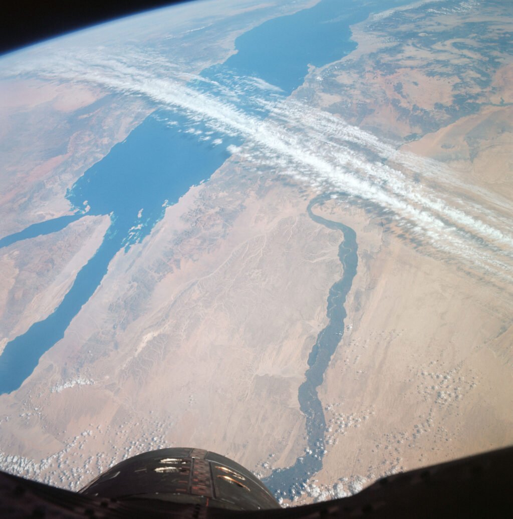
Sixty years ago Saturday, Gemini XII astronauts Jim Lovell and Buzz Aldrin photographed the Nile Valley and the Red Sea from orbit. NASA revisited the image this week as a reminder of how early astronaut photography helped make the case for satellites dedicated to studying Earth.
The Gemini photos helped persuade scientists that repeated views from space could reveal changes on the ground. NASA and the U.S. Geological Survey launched the satellite later known as Landsat 1 in 1972. Landsat data are now used to track changes in crops, vegetation and land use, among other applications.
Una foto de Gemini XII cumple 60 años y recuerda los orígenes de Landsat
Hace 60 años, un día como hoy, los astronautas Jim Lovell y Buzz Aldrin fotografiaron desde la órbita el valle del Nilo y el mar Rojo durante la misión Gemini XII. La NASA volvió a difundir la imagen esta semana para recordar cómo las primeras fotografías de astronautas ayudaron a justificar el uso de satélites dedicados a estudiar la Tierra.
Las fotos de Gemini ayudaron a demostrar que las observaciones repetidas desde el espacio podían revelar cambios en la superficie terrestre. En 1972, la NASA y el Servicio Geológico de Estados Unidos lanzaron el satélite que luego se conocería como Landsat 1. Hoy, los datos de Landsat sirven para seguir cambios en los cultivos, la vegetación y el uso del suelo, entre otras aplicaciones.
Sources / Fuentes: NASA History Office; NASA Landsat.
Photo credit / Crédito fotográfico: NASA.
About The Author




More Stories
Renwick Gallery opens a new look at contemporary American craft
NOAA confirms more than 8,000 U.S. marine mammal strandings in 2025
NASA aligns the instruments on its Roman Space Telescope